Working with Avon
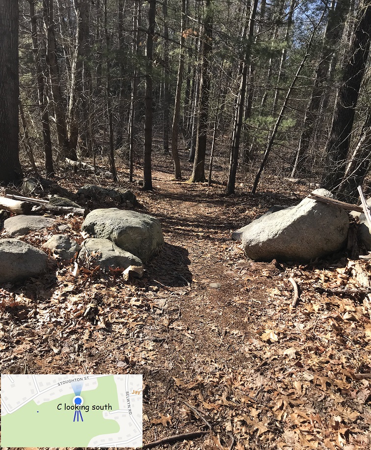
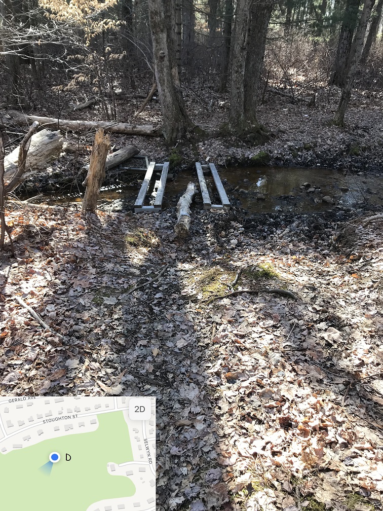
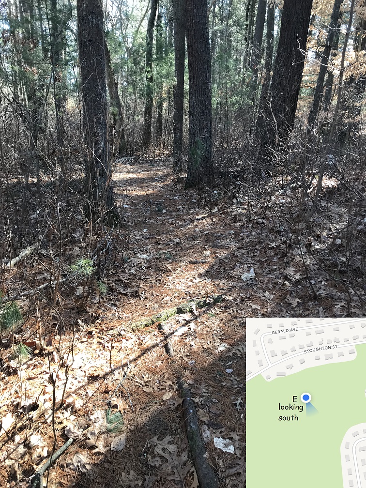
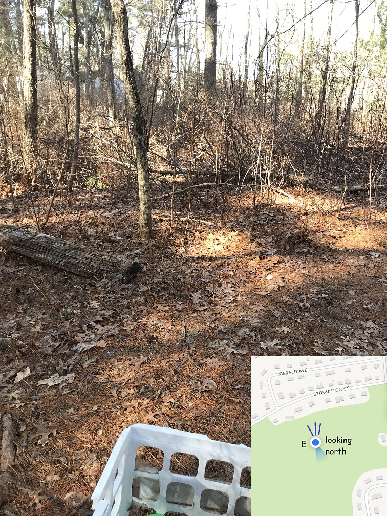
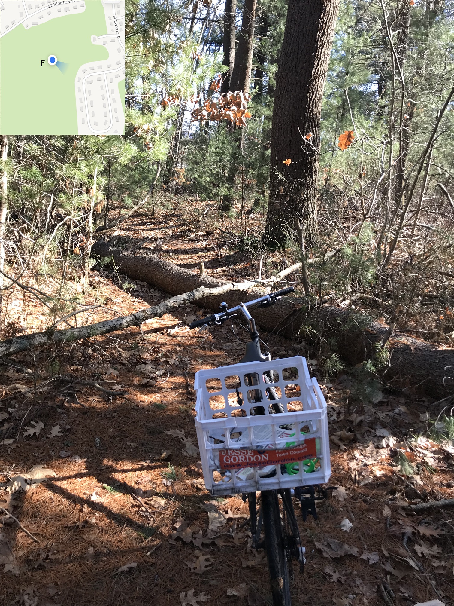
You can follow the trail through Lokitis in the "photo essay" below -- each is labeled with a letter frmo "A" to "Z" which are marked on the map at the upper right (which you can click to enlarge). A GPS position is shown on the thumbnail of each photo with the same letter code; click each one for a high-quality photo.
Introduction to Randolph's Biggest Conservation Area
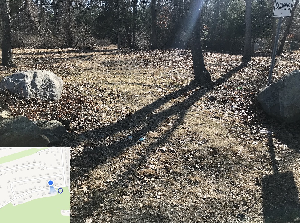 Randolph has a HUGE Conservation Area right in the heart of South Randolph -- but it has been closed to the public for decades! It's called the Lokitis Conservation Area, at the southern end of Highland Ave where it meets Stoughton Street. It was designated a Conservation Area many years ago -- but the abutters complained about cars parking nearby (a parking area was actually cleared!) so boulders were placed along the entrance, with "No trespassing" and "No Dumping" signs to scare people away.
The negative signs have worked -- for years, no one has gone in. Except people who interpret the lack of public usage as a reason to dump their private trash there. I've seen car parts, abandoned couches, a broken TV, trash bags and leaf bags -- basically, our public park has been transformed to a public dump. This is what ALWAYS happens when public usage is locked out of wooded recreation areas -- the alternative isn't "nice woods with no parking" -- it ALWAYS results in "once-nice woods contaminated by public dumping" -- and it's time to fix it!
 I have two stories from neighbors of Lokitis. One is an older couple who live just across South Main Street. I said to them, "You could walk from your house to the Conservation Area, and then cut through the excavation grounds and the Avon Industrial Park to DW Fields." The husband said, "I never heard of such a thing and I've lived here 50 years." The wife responded, "Oh, yes, you've heard of it -- Junior used to do exactly that with his friends every summer weekend!" I did the same with my son and his friends -- but for the last few years the excavation grounds have "No entry - Blasting" and indeed they do blast there -- so we need a better way through the woods!
I've got another friend a few blocks north who walks the length of Highland Ave to South Main Street every day. I said "Well, the entrance to Lokitis is right on your walking route! You could add it as part of an off-road walk!" She responded, "That's a public park? I've walked past it for decades and all I've seen are the 'No Dumping' signs!" Those signs are the PROBLEM -- they keep people OUT -- now we're going to put up "Welcoming Signs" to encourage people to go IN!
 I got a grant to pay for the signs, in 2022, from the CPC, the Community Preservation Committee. It's for signs at Lokitis and several other "closed parks" -- I'll get to the other ones over the next couple of months. Lokitis is first because it's so big; it's so beautiful; and it's so closed to the public. I'd like to make that case to the people of Randolph -- because I have gotten "push back " at EVERY step of the way, and I need your help to overcome the naysayers!
Here's why it's urgent: The Randolph Community Wellness Plan outlines why public parks are important -- they're free for everyone; they provide for physical health and mental health; undeveloped wooded areas serve as a connection to nature in small cities like Randolph; so every neighborhood should have some parks. Look at the map on my CPC application info -- Lokitis is the ONLY park in South Randolph! (There's one other smaller "South Randolph Conservation Area" mentioned there -- but the CPC declined to fund re-opening that one -- we'll re-apply next year!) The Community Wellness Plan CLAIMS that most of South Randolph is well-served by parks because half of the neighborhood is within walking distance of Lokitis -- but as you can see from the stories above, even long-time neighbors feel locked out. So to make the Community Wellness Plan a TRUE plan, we need to open up Lokitis! Here's how....
 The CPC grant allows us to put up a sign at the Lokitis entrance, as long as (1) we follow "sign guidelines" and (2) get DPW to do some cleanup. The Town Council Subcomittee on Recreation added two more rules: (3) conduct a survey to demonstrate that people want to spend town resources on parks; and (4) create a map that portrays the walking trails and borders reasonabky accurately.
I've taken on one more task because of the past push-back to town officials: (5) Personally notify the abutters before the sign gets posted, so they're not taken by surprise.
The CPC grant allows us to put up a sign at the Lokitis entrance, as long as (1) we follow "sign guidelines" and (2) get DPW to do some cleanup. The Town Council Subcomittee on Recreation added two more rules: (3) conduct a survey to demonstrate that people want to spend town resources on parks; and (4) create a map that portrays the walking trails and borders reasonabky accurately.
I've taken on one more task because of the past push-back to town officials: (5) Personally notify the abutters before the sign gets posted, so they're not taken by surprise.
Following are Five Tasks to Open our Biggest Municipal Park. Oh, and for some statistics on the term "biggest":
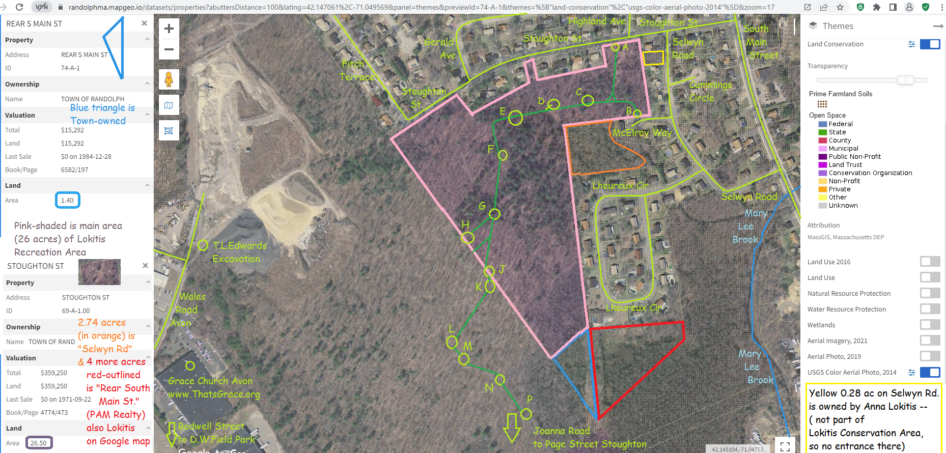
- Lokitis is 35 acres including two entryway parcels shown on large map (click on upper right thumb photo).
- Powers Farm is 28 acres including the new 6-acre "Rear Niles" parcel which is not yet open to th public.
- The Reservoir Walk area is 321 acres, but that's 90% water, leaving about 32 acres of conservation land.
- The Blue Hills State Park has over 700 acres in Randolph but that's a state park, not a municipal park -- and I'll detail in a few weeks about adding "Welcoming signage" there too!
Five Tasks to Open our Biggest Municipal Park
- Follow "sign guidelines": The CPC and Conservation Commission very much want all park signage to be consistent and recognizable -- and I agree with those goals. I proposed to the CPC defining "signage standards" and I brought in the state's Blue Hills State Park signage standards as an example. The CPC concluded that those standards were fine and there was no need to define a new standard. Several naysayers insist that the new signs at Lokitis follow the "Randolph standards' -- but I've been asking for documentation on those standards for months with no results! I've got plenty of examples now -- from Powers Farm; from the Blue Hills; from other planned Randolph signage; from DW Fields Park (shown at right) -- so I'm going to design them myself and trust DPW to build them appropriately. This isn't rocket science -- it's just "street-sign science" -- so here are the standards:
- Use a wood frame -- no steel pipes and no plastic
- Weatherproof it with that little roof on top
- Important message is "Welcome to Lokitis Conservation Area" in big lettering -- no negative messages on this sign -- existing "No dumping" signs are plentiful
- A map shows where you are, where you can go, and what's nearby
- Randolph town logos included (Town Seal; and RICC "R")
- Indicate nearby off-street parking with the "blue P" symbol.
- Hints toward the other recreation areas nearby (actual directions on the web page).
- A QR Code to a town web page with an electronic copy of the map and details about Lokitis Conservation Area
You can help with this task by contacting the Town Council or DPW to say something like "Yes, making welcoming signs is needed; let's do it".. Input from residents is very important -- I hear from people myself, but other in Town government should hear it too!
- DPW cleanup:
There is a lot of trash and debris dumped at Loktiis, and part of the CPC grant is to cover DPW time or overtime to do some cleanup. I've asked DPW to expect to bring a dump truck and 2 or 3 staff to haul out the large debris -- probably a full day's work. I will volunteer to assist -- you can too! -- it'll be like the "Town Cleanup" -- we can pick up litter while the DPW handle the big items.
There's an ongoing cleanup task too -- the DPW should periodically trim the lawn in the "parking area"; pick up litter; and do some trail maintenance. I've asked the Town Manager to increase staffing on DPW for this purpose. We added three DPW staff last year -- which I suggested and supported -- and I think three more is about right. Their role is for street infrastructure and water infrastructure too, but we're adding ongoing additional tasks for park maintenance. I'd like to see a new DPW Department of Parks and Recreation -- but we'll get to that next year. .
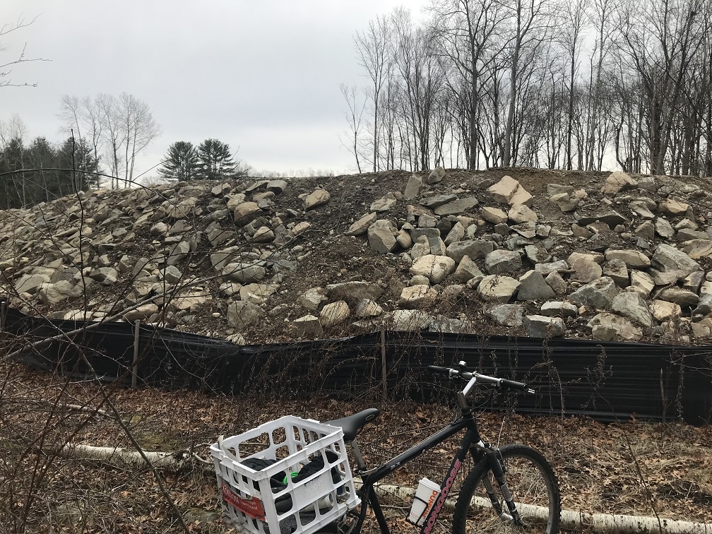
My CPC grant called for DPW to move some of the boulders that had been placed along Stoughton Street to physically block cars from entering the cleared "parking area". The ideal situation would be an entrance directly south of Highland Avenue -- as if you were just continuing straight across Stoughton Street. But to do that would require a "curb cut" which is very expensive. There is a opening between the boulders a couple hundred feet west of Highland Avenue on Stoughton Street -- that will do! My plan is to place the sign right next to the boulder that was moved to allow car entry into the parking area -- see photo.
- Park Survey: The Town Council Recreation Subcommittee requested that I conduct a survey to demonstrate that the people of Randolph are interested in spending Town resources on parks and recreation. That's already been well-established, but I agreed to conduct a survey because it'll publicize our newly-open park areas, and will establish a "baseline" of usage statistics for future years. The survey will be conducted by the Board of Recreation, via the RICC email list, with publicity around town to get more participants -- of course anyone reading this should take the survey -- it'll be open for responses during March 2023.
The "well-established" level of interest is from two sources. First, the Randolph Master Plan has several goals dedicated to improving park and recreation access -- that Master Plan was created by input from the people of Randolph -- it is, in effect, the summary of a massive town-wide survey. Second, the Master Plan Implementation Committee, on which I serve as the Town Council representative, set up a survey about the Master Plan at the Harvest Hoopla event last autumn. We asked the people of Randolph to vote for which section of the Master Plan they want the Town of Randolph to focus on (there are 7 sections) -- "Open Space and Recreation" won the survey by a large margin. .
- Create a Trail Map: the map will be printed on the Welcome Sign, and on the Town web page for this Conservation Area. The map should portray the surrounding streets and entrances, plus the walking trails and Conservation Area borders, reasonably accurately. The goal is to let people know where they can enter and exit without bothering any neighbors; how to enjoy the trails without getting lost; and where the nearest other parks are.
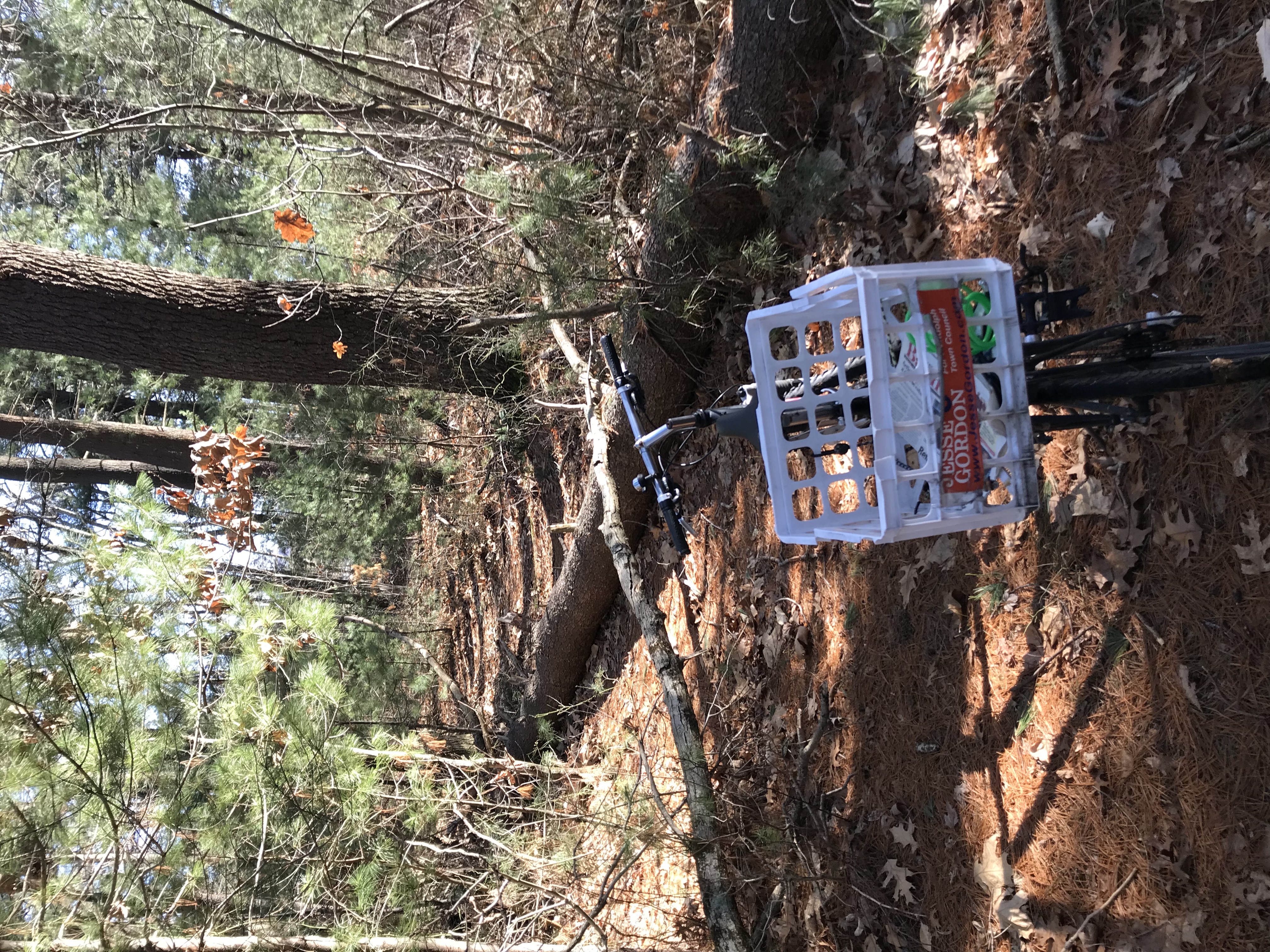
You can help with this task by "mapping" the Conservation Area. This is a challenging task -- it's like "surveying/orienteering" in the woods, using tools like a phone GPS that we can carry with us. I prefer a mountain bike to speed up getting around, but if you prefer hiking, we can go on foot. Then, out of the woods, the task is "cartography" drawing the trails we find, superimposed on a street map. Drawing the map shown at the top required several hours repeated over several sessions -- and after it's all drawn, it has to be prepared for printing on a 4-foot-wide sign. I've asked the local Boy Scout troop to help, but if you'd like to volunteer for this Conservation Area or others, please contact me (text 617-320-6989)!
- Notify Abutters: I understand that abutters of Randolph's parks often prefer that others not use our parks, and especially that others not park on their street. Some abutters have sued the Town of Randolph (and lost their lawsuits, but cost the Town a lot of money to pursue court action). Many abutters have yelled at me for "trespassing" when I'm careful to only tread on Town-owned land -- in other words, they yell at me to intimidate me from entering on public land into public parks.
To abutters who want to keep people out of our public parks -- I've heard you, over a period of many years, and I respectfully disagree. Part of being respectful is that I'm willing to listen to those arguments again -- and respectfully disagree again. My plan is to knock on the door of every abutter, to deliver this plan in person, before installing the Welcome sign. My respectful disagreement will focus on the fact that keeping people out of public parks results in public dumps -- we've tried that for many years, and endured a public dump for many years, and now we're going to try letting people into our public park, and hence replace the existing public dump with an actual public park.
To abutters who want to stop people from parking on public streets near public park entrances -- I'd like to work with you to minimize parking in front of your houses. That means creating off-street parking areas near our public park entrances, and including information on the Welcome sign recommending off-street parking nearby. This is a compromise -- sometimes the parking areas will get full and people will park on the public street in front of your house -- but usually the off-street parking areas will get used. In exchange, how about we all let parents take their kids into the woods on a nice day, and please don't yell at the pedestrians and please don't sue the Town?
Working with Avon and Stoughton:
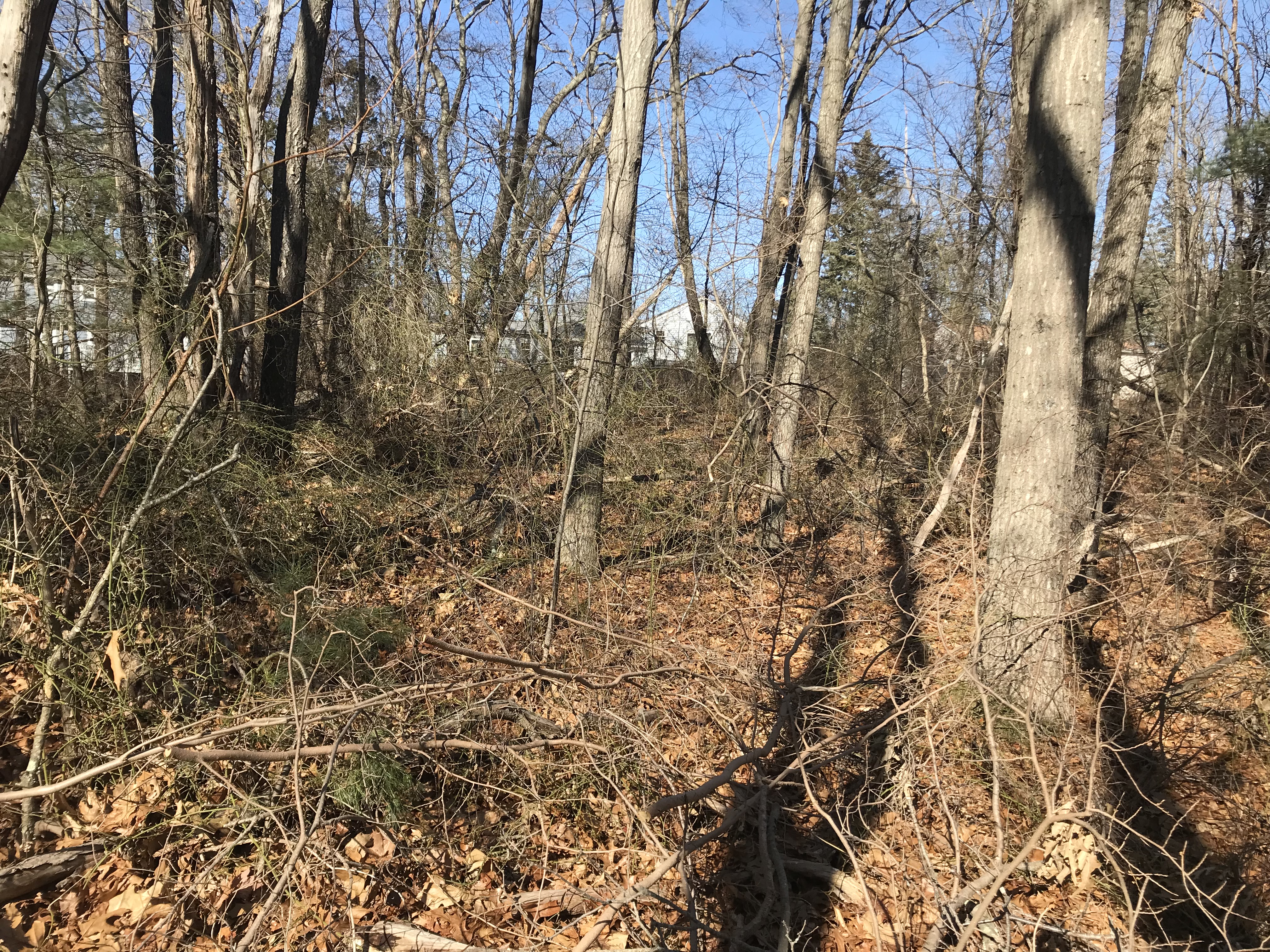
The hiking trails exit Randolph at this point, which means you're no longer in the Lokitis Conservation Area. Currently, the only path out is to turn around and exit back at Stoughton Street on the north. Next year's project is to make an exit from the south side -- to South Main Street in Randolph, or to Avon across the border. Following is a photo essay of where the trail goes....
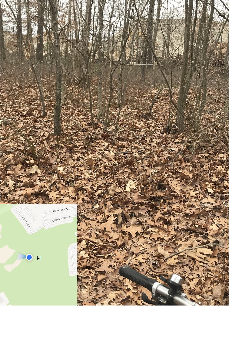
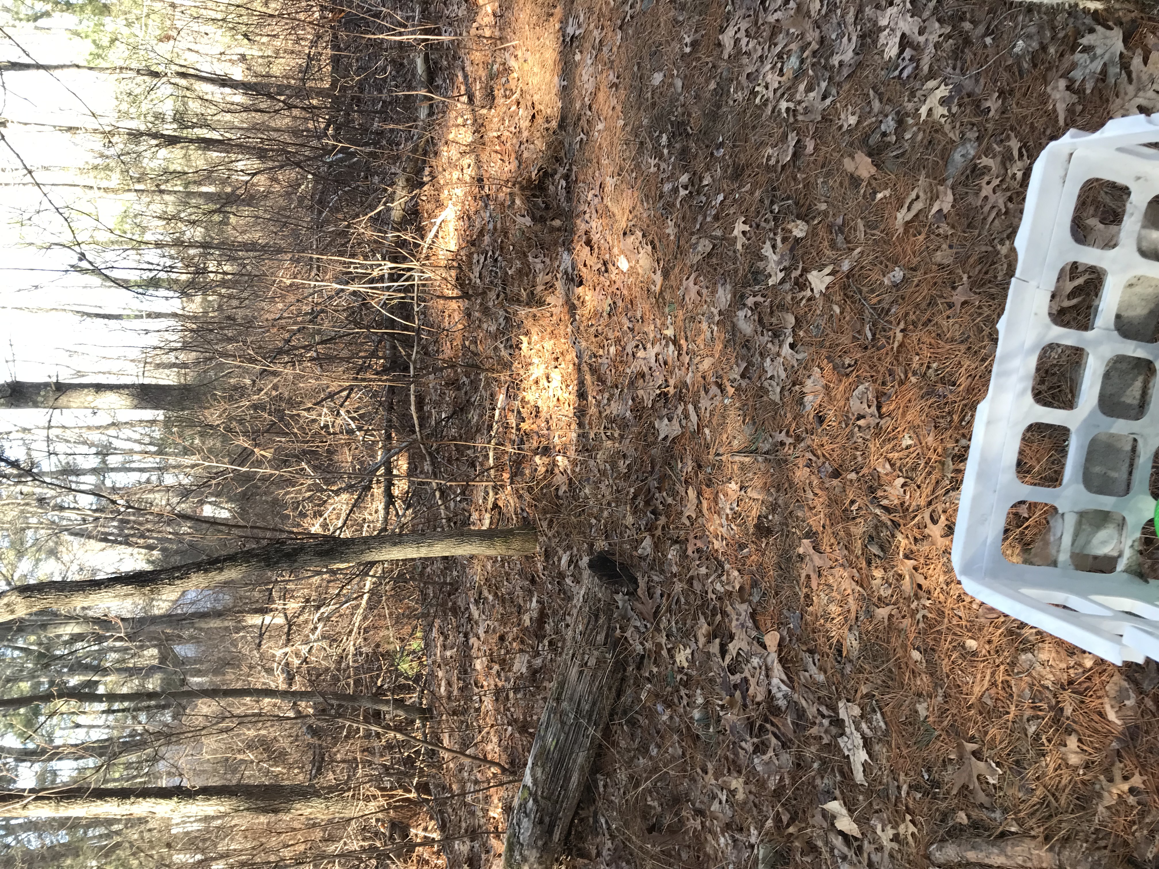
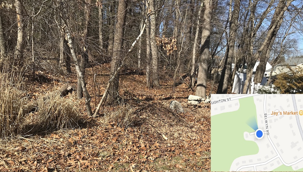
Point "H" on trail map:
There's a pink ribbon on a tree if you look closely -- maybe that marks a property boundary or maybe it marks the Avon border. There are other ribbons in this area -- and a lot of stone walls too -- the trail is on Avon property here so I'll have to write to the Avon Select Board to understand the property details.
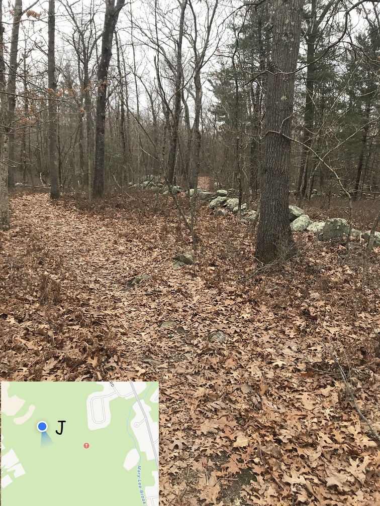
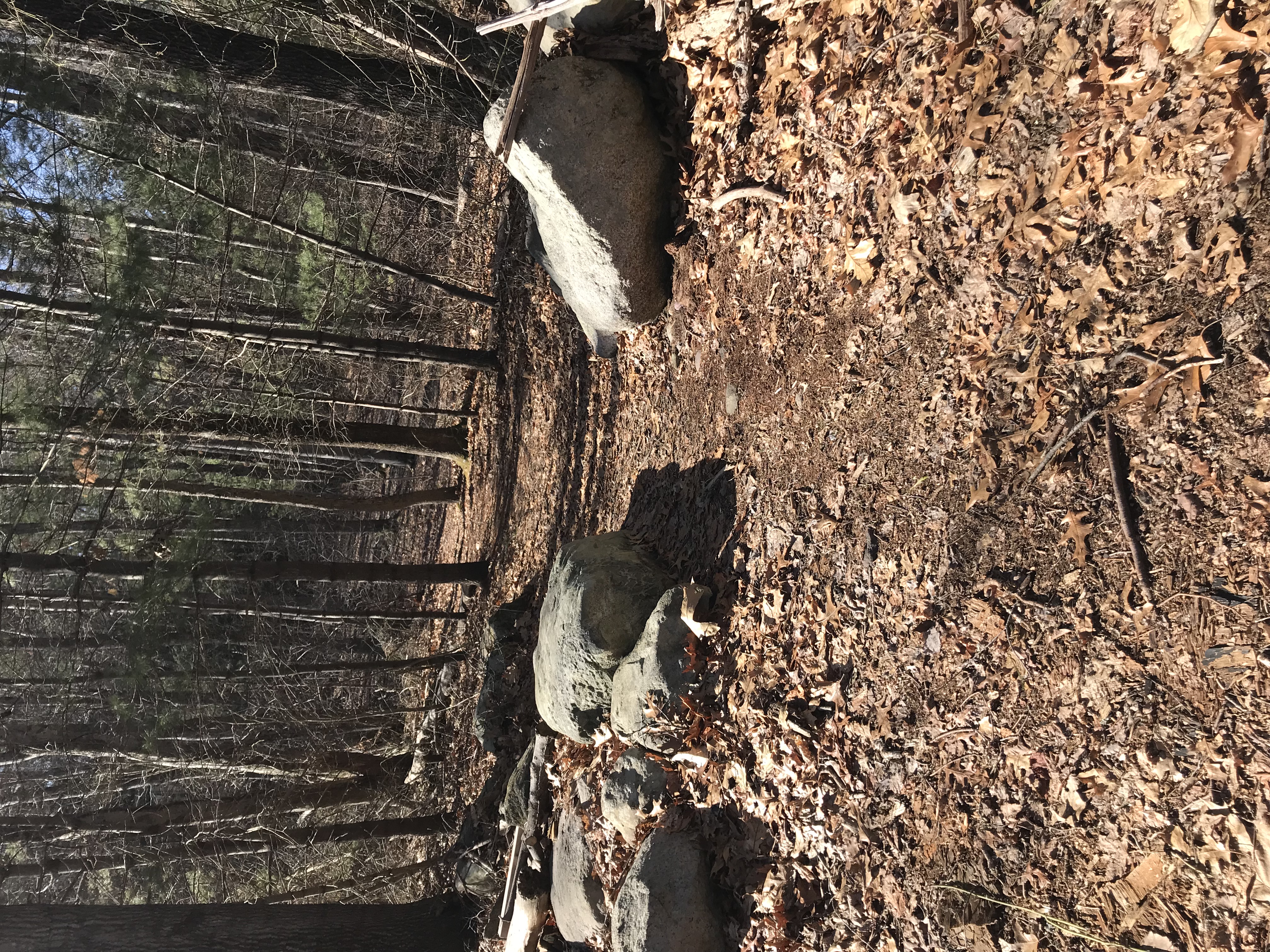
Point "J" on trail map:
Some caution is needed in this area -- that's the excavation company in the background, T.L.Edwards, who posted the "Blasting" signs on the corner of Stoughton Street and Fitch Terrace. Those "Blasting" signs are why I stopped going through that area of the woods -- the trail ends up here. I'll ask T.L. Edwards about their blasting schedule -- I suspect it's never on weekends when most people might take a hike -- and maybe we'll post some "Blasting" signs on the hiking trail too. Sometimes there's a fence but some trails do let you walk right onto their property -- but I think that's a bad idea -- please follow common sense until we get some signs posted that tell the situation.
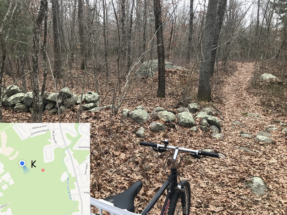
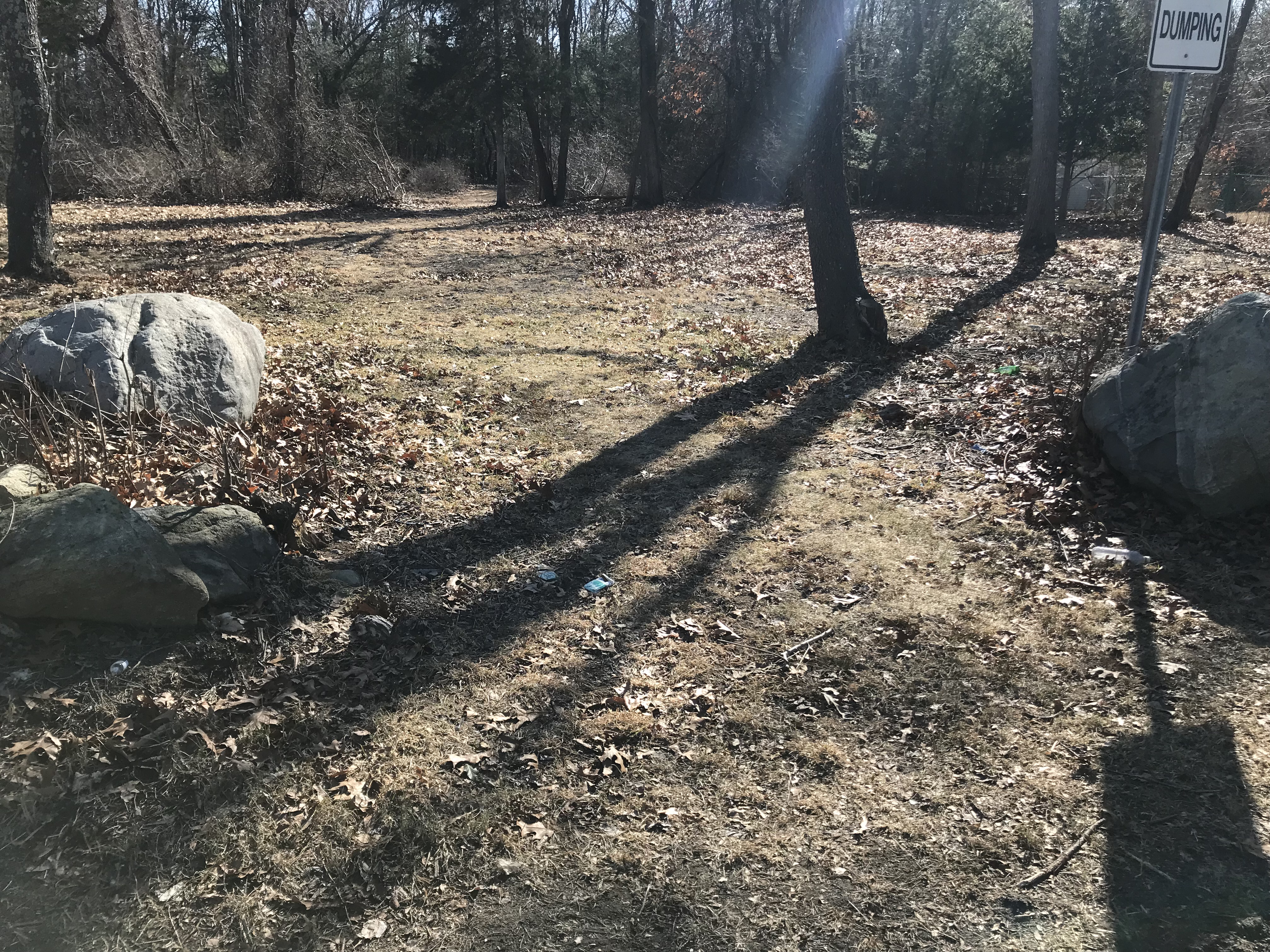
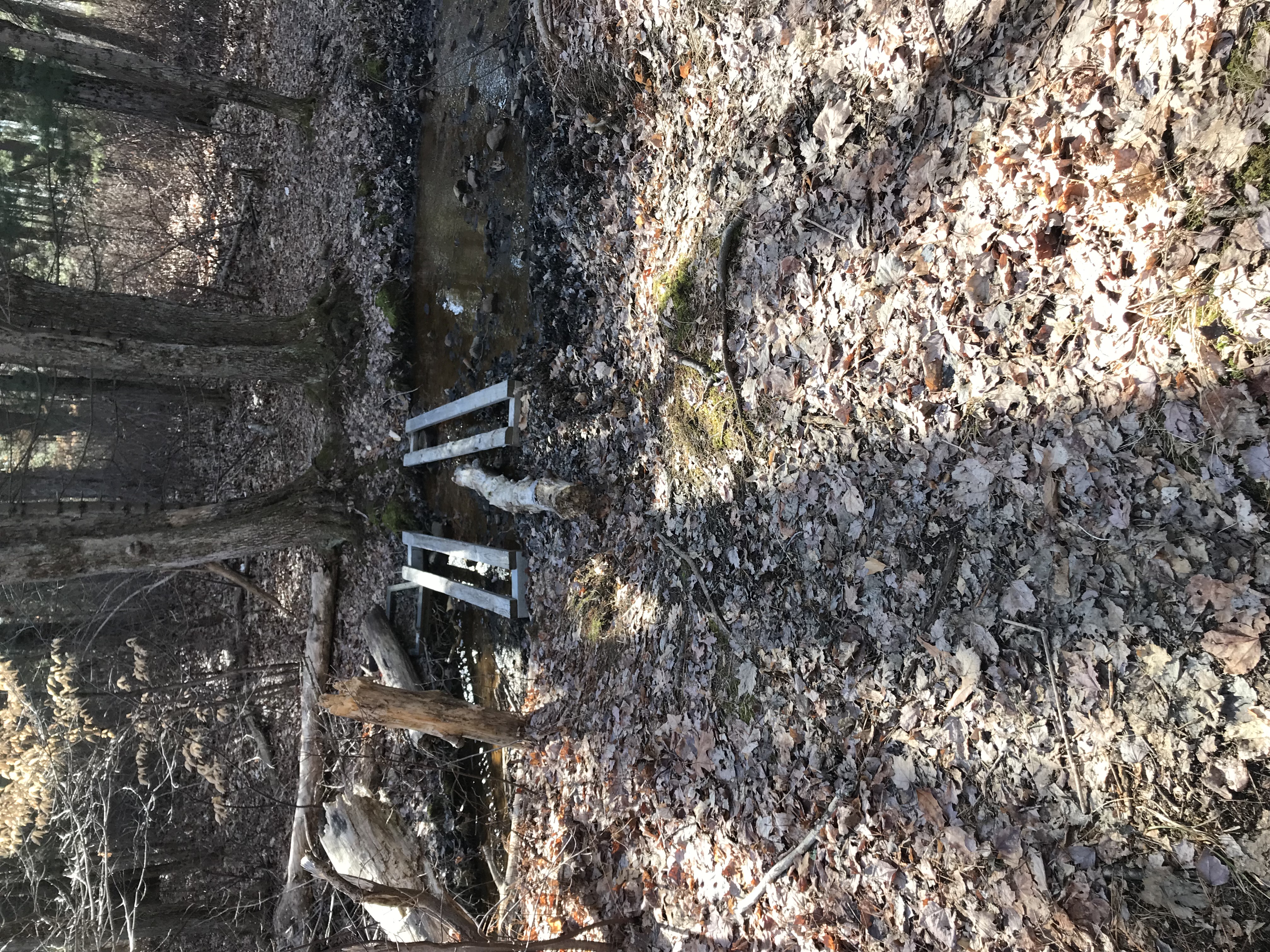
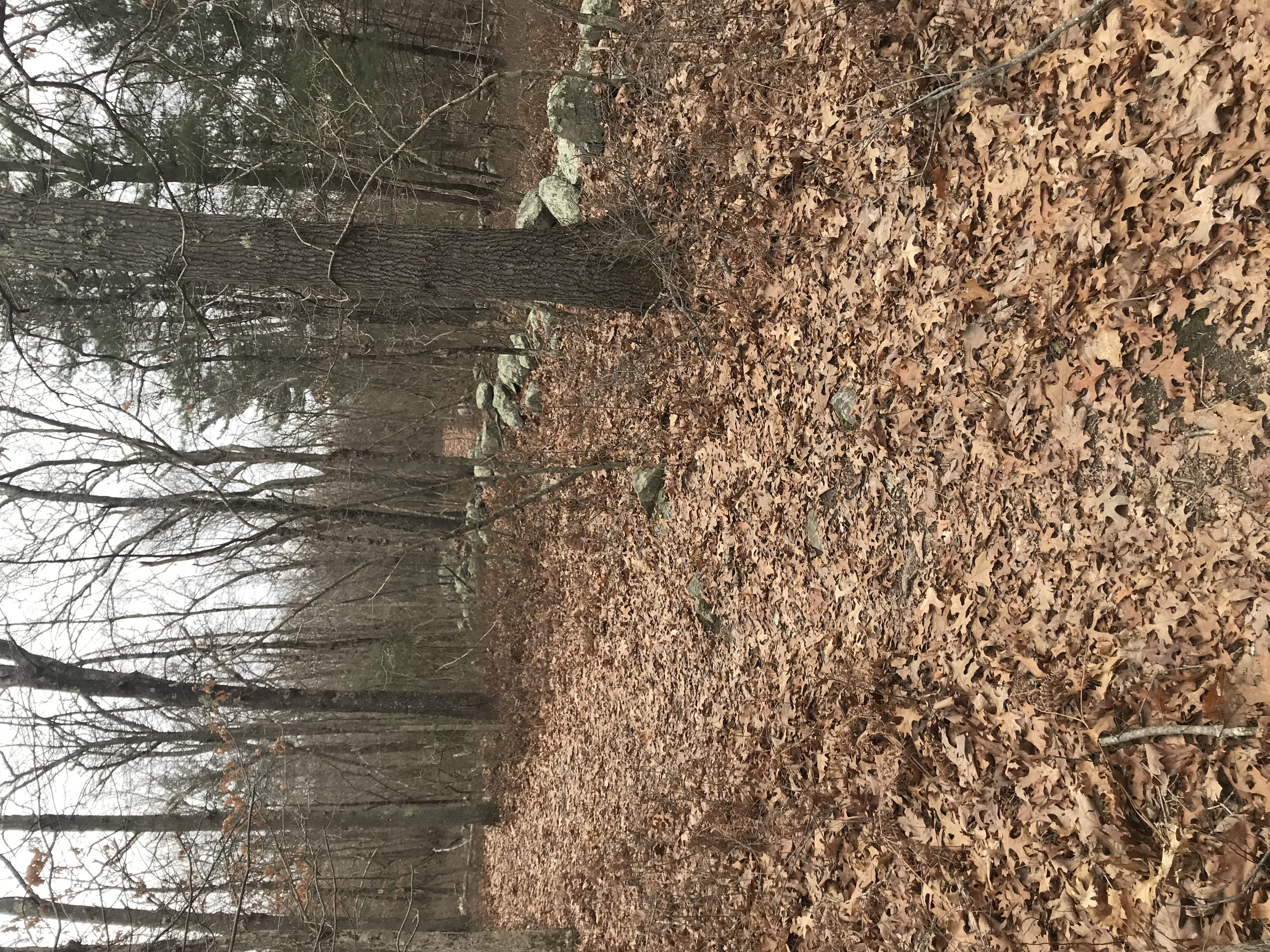
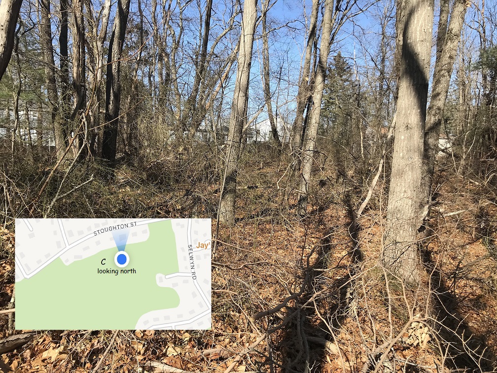
Point "K" on trail map:
Those are stone walls in the middle of the woods -- there are lots of them! These were traditionally used as property boundaries centuries ago, and no one ever took them down. For the next few photos, this is a potential walking route to Grace Church and other businesses in the Avon Industrial Park. Grace Church is on Wales Ave. in Avon, and some parishioners there told me they knew about the nearby Lokitis woods when I described this project.
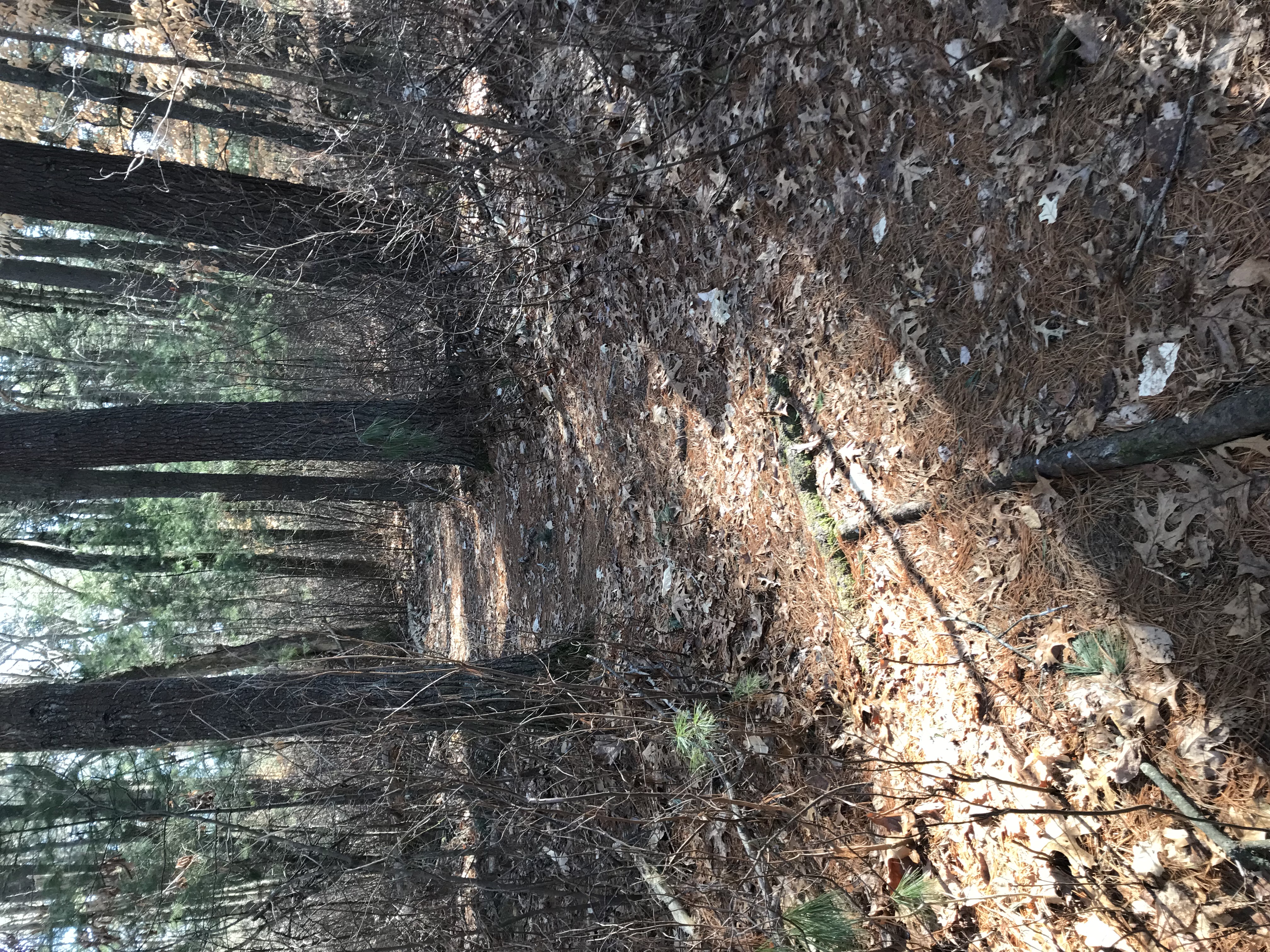
Point "L" on trail map:
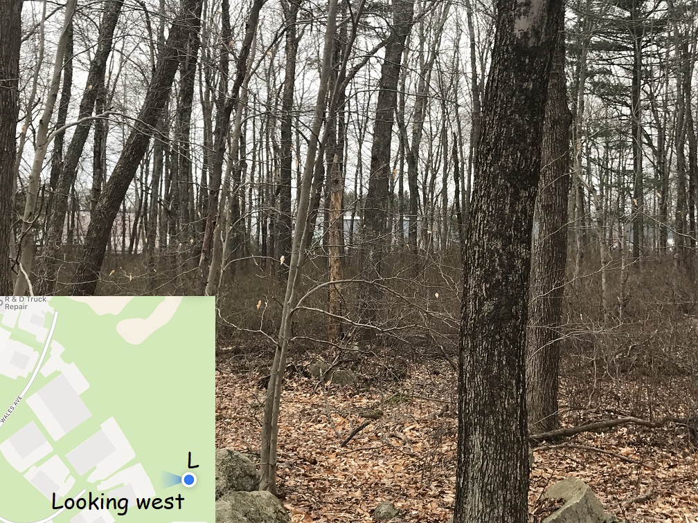
You can see Grace Church's parking area from the hiking trail. It's not really open to pedestrians it exit the parking lot -- there's a stream and a lot of brambles. But I have exited the trails there -- it's "open" to anyone willing to get their feet muddy and bushwhack a little. I'll ask Grace Church and other businesses if they'd like to get mentioned on the map, and work in the future towards opening up a walking path. From their perspective, it'd be a nice walk in the woods after Sunday services; from the Randolph perspective, it's a route out of Lokitis to the south.
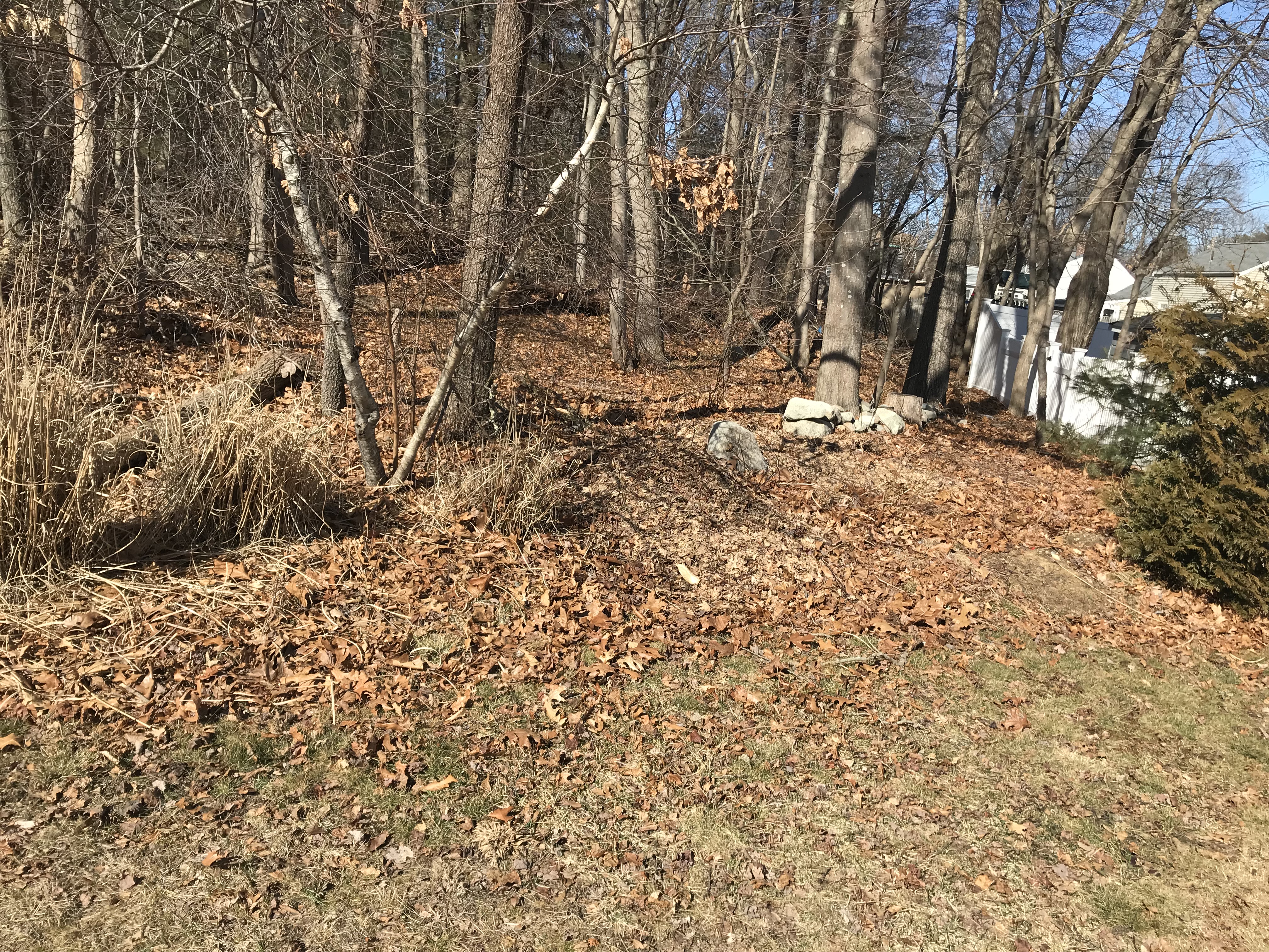
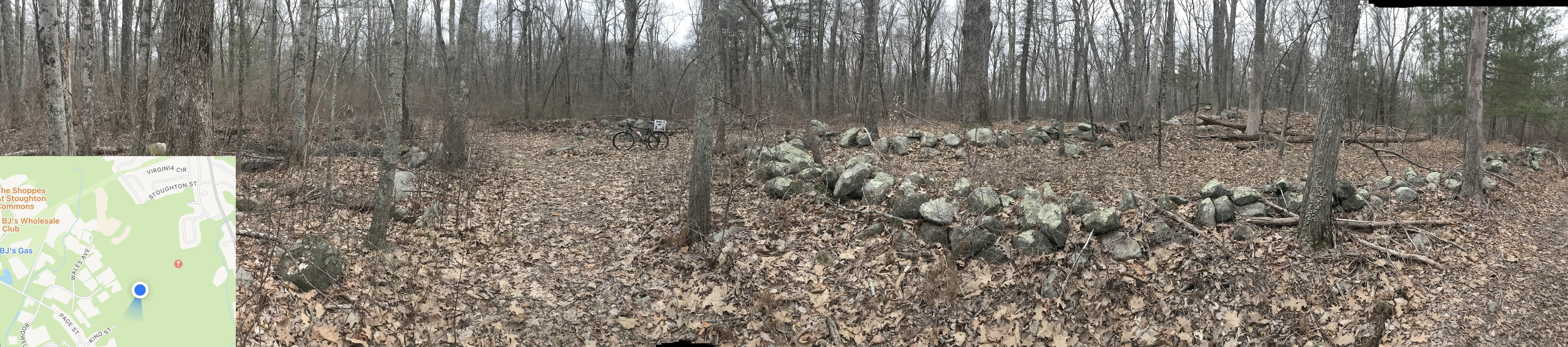
Here's a panorama from point "L" on the trail map. showing several stone walls:
Point "M" on trail map:
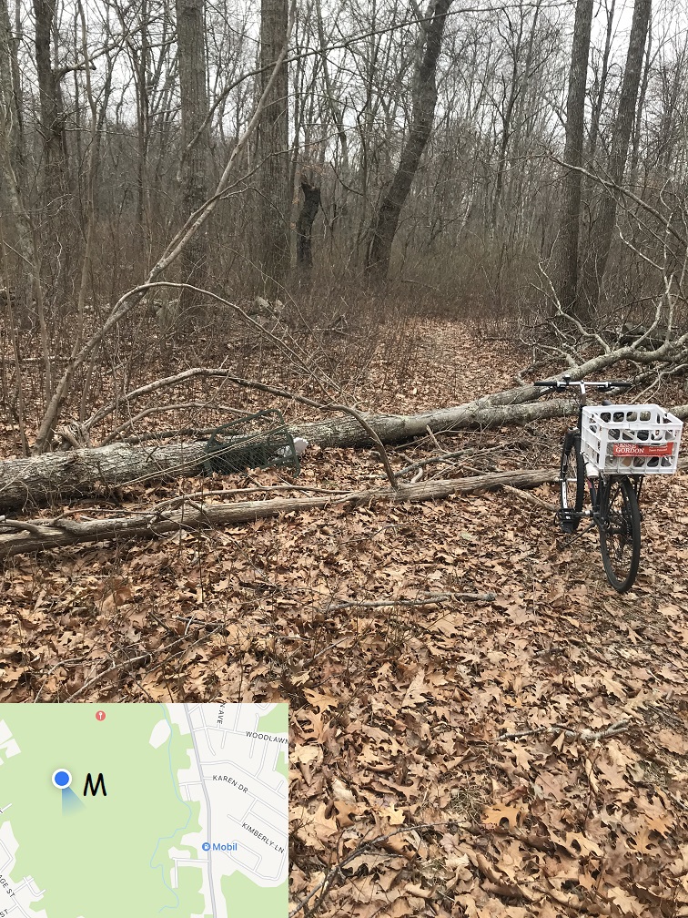
There's some trash in the Avon woods too -- unused woods turn into dumps everywhere, not just in Randolph -- it's just human nature. The Randolph DPW won't clean up here, but if we make a deal with the Town of Avon, trail maintenance here might be done by the Avon DPW.
Point "N" on trail map:
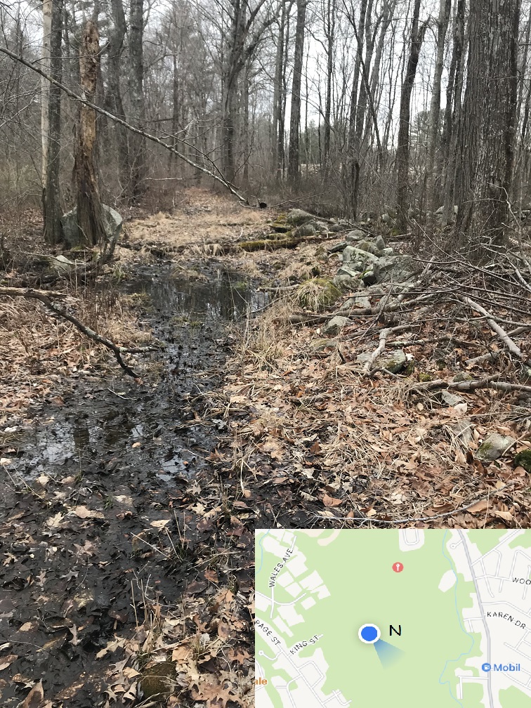
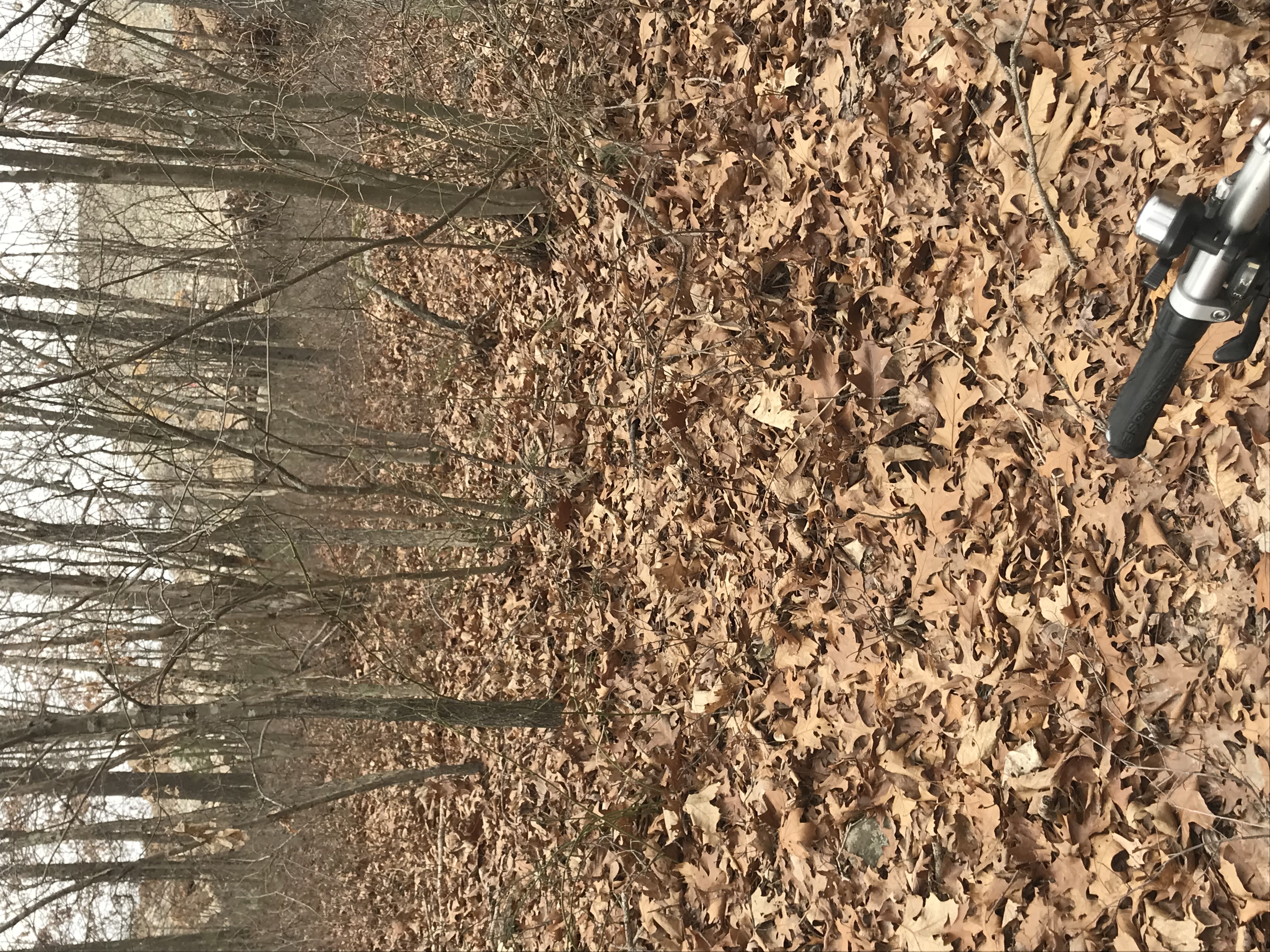
This whole area -- both Lokitis in Randolph and the Avon side of the border -- are considered wetlands. But that doesn't mean your feet get wet in too many places -- this is one of the few. Yes, there are some swampy areas, and after a rainstorm there'll be some mud -- but generally the entire Lokitis Conservation Area is dry enough for hiking with regular shoes. A "wetland" really just means it's a low-lying area that is often wet -- and that it harbors a lot of wildlife and plant diversity. That's what makes wetlands great places to experience nature.
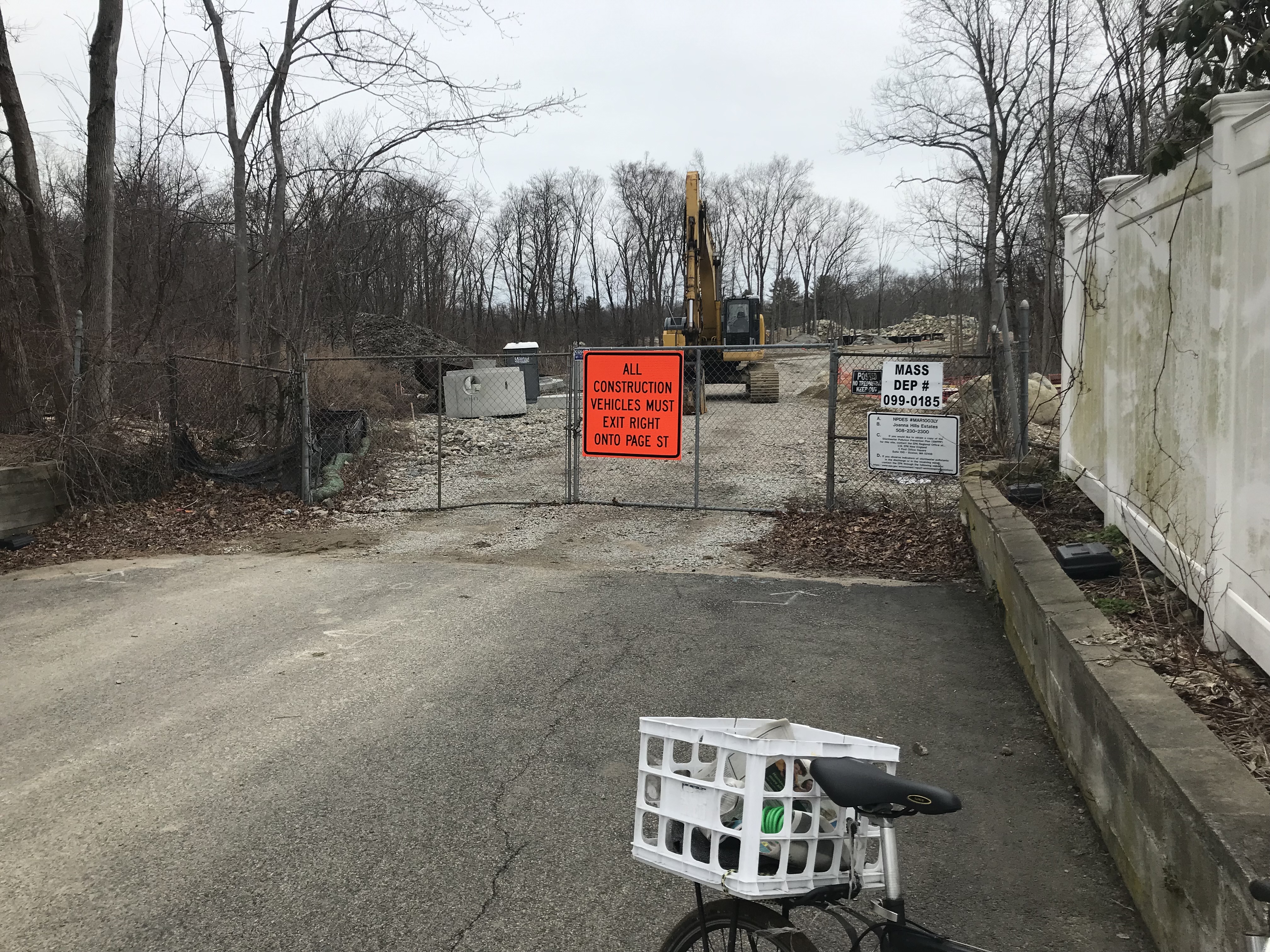
Point "P" on trail map:
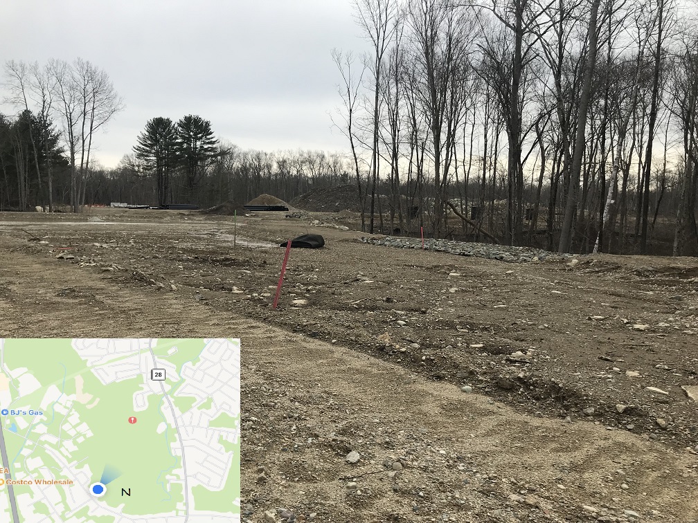
Here's what I'd like to see as the southern end of the hiking trail -- it's a new development a the end of Joanna Road in Avon. If the developer is forward-looking, there'll be a "welcome sign" in the new development with the same map as ours, in the future. I will contact this developer to ask -- I'll post the details when known!